
In the 2019 IMD report, Haringey is one of the poorest boroughs among the 32 boroughs, ranking seventh overall, and 30% of the districts are in extreme poverty. Transport is the third largest source of emission in this borough. Haringey council declared a Climate Emergency in March 2019, being one of the first London Councils to do so. They need to reduce emissions from road transport by growing public and active travel options and infrastructure, to enable a reduction of all petrol and dissel journeys of 50% by 2024.
Haringey is still car-oriented, and the inconvenience of intermittent pedestrian travel can be seen everywhere in the entire borough. Haringey council has collected public voice; and our group organized public voices into the interactive map on the left, from which users can see feeling, position, issue, suggestion and attitude of residents who live in Haringey when their mouses hovering on these points. From the feelling scores of local residents on daily travel, it can be seen that a considerable number of people are dissatisfied with the current traffic situation. Local residents are plagued by various conditions such as road congestion and irregular road usage.
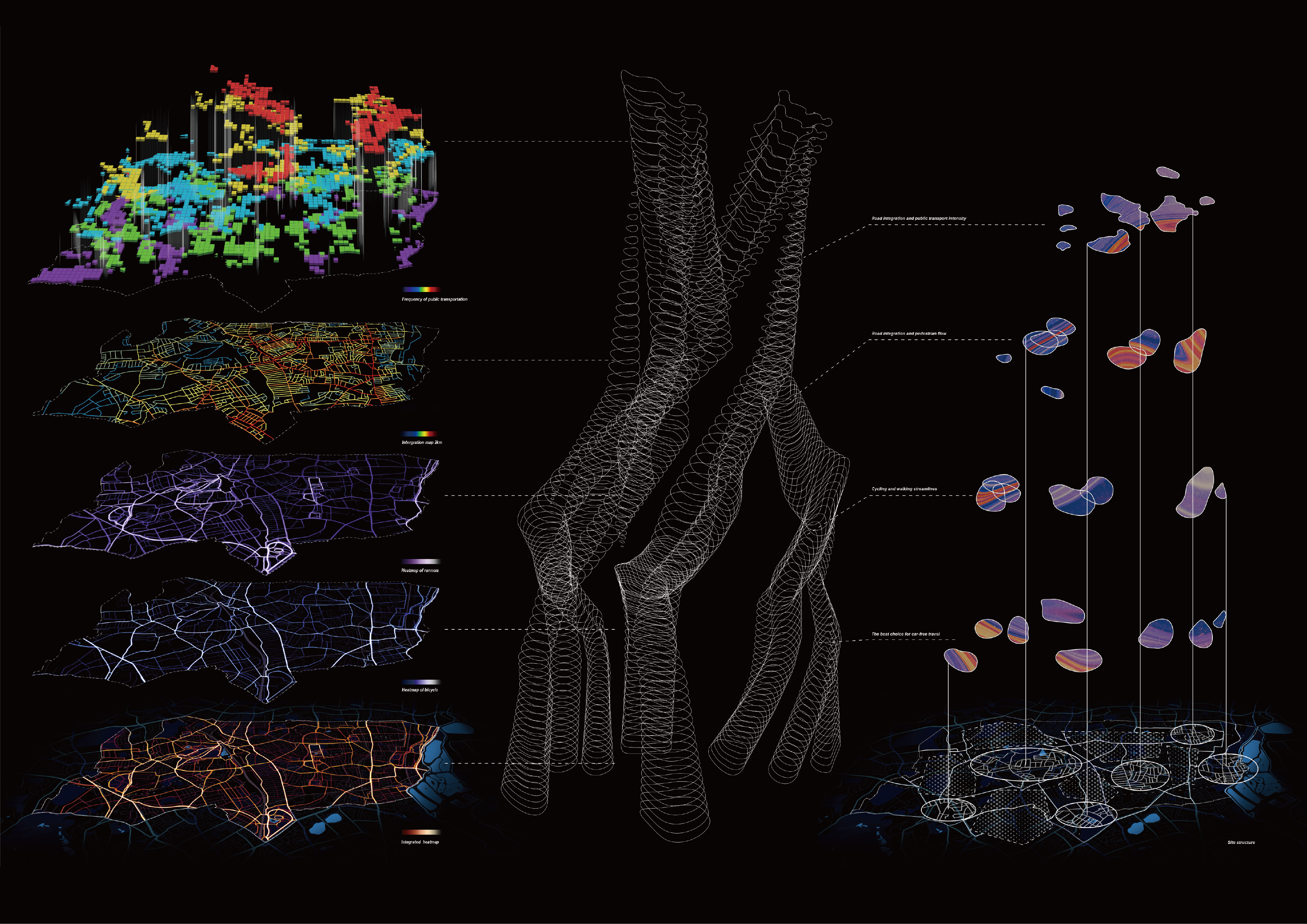
After the general problem of satisfaction in the local area, we decided to compare the degree of spatial integration calculated by the most frequently used roads and the heat map of walking and biking from a more objective degree of public transportation use, and try to determine the design selection area. We extracted the part with the highest value of each data, made a model that continuously merged between each element selection area, and overlaied the intermediate value of each numerical model again, and got a comprehensive, blurred regional boundary. Finally, we superimpose them together, which is roughly the area where the local pedestrians travel by non-private cars. We can choose the most frequent areas of these activities as the boundaries of the local life circle we will design in the future, and the spaces connected in each area as the transition area to expand our design.
⋘ click on the picture to zoom in and out